Old courses and less related courses
-
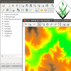
MEA592: Multidimensional Geospatial Modeling
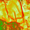
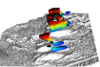
The course covers concepts, methods and tools for analysis and modeling of landscape dynamics using multitemporal georeferenced data and simulations. Representation of evolving phenomena using point clouds and particles, surfaces and voxel models will be explained. The course will also include hands-on practice and development of techniques for visualization and communication of lidar data time series and outputs of dynamic simulations using the state of the art technology in the GIST Visualization laboratory, such as 3D projection, immersion and tangible modeling system.
-
LAR 582.017: GIS for Designers
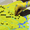
This course will focus on how GIS can be an integral part of the creative design process. You will be taught terrain, hydrological, and overlay modeling and analysis in two and three dimensions. You will also learn how to generate and develop the seed of a design in GIS as part of an iterative design process. With visual programming students will learn how conceptual and logical models can structure and generate designs, linking creative abstraction, computational exploration, structured decision-making, and expression. As part of an iterative design process students will learn workflows linking 3D GIS, 3D modeling, and rapid prototyping (3D printing, CNC fabrication, and laser cutting).
-
GIS/MEA792: Advanced Geospatial Modeling
The course provides foundations in methods and algorithms used in GIS modeling. Special focus is on integrated modeling using vector and raster data processing, data base management tools, basic image processing, and python programing for open source GIS. The course includes workflow development combining different tools from open source geospatial software stack especially GRASS GIS, GDAL/OGR, libLAS and others. Applications / case studies will include terrain modeling, geomorphometry, coastal evolution, volume modeling, dynamic visualization, and GIS-based modeling of landscape processes (water, sediment).
-
GIS 550: Geospatial Data Structures and Web Services
This course examines the spatial database models and structures used in geospatial information science and technology as well as the design and implementation of web and related mobile computing geospatial tools and systems. Students develop, evaluate, and deploy multiple spatial data models and web services that include connections to external data sources and systems.
Old tutorials and less related tutorials
-
Geospatial Analysis and Modeling with GRASS (GRASS Clinic)
The short course provides introduction to GRASS GIS and its tools for terrain modeling, geomorphometry, and analysis of elevation data time series. The course includes analysis from lidar data, 3D visualization and exploration of terrain change.
Make sure you check our current courses and tutorials.