Projects
-

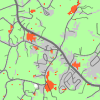
Pest or Pathogen Spread Model (PoPS)
PoPS (the Pest or Pathogen Spread Model) is a framework for modeling the spread of pests or pathogens across a landscape. PoPS can help decision-makers, researchers, and students create geospatial distribution models. PoPS can is distributed as R package and GRASS GIS module.
-
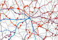
FUTURES
FUTURES, FUTure Urban-Regional Environment Simulation, is an open source urban growth model specifically designed to address the regional-scale ecological and environmental impacts of urbanization and is one of the few land change models developed to explicitly capture the spatial structure of development. FUTURES is being developed and distributed as GRASS GIS addon.
-
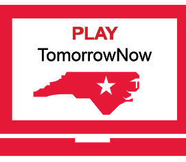
TomorrowNow
TomorrowNow is a collaborative project led by four universities in North Carolina focused on developing a serious game that can help a greater number, and a greater diversity, of people affect decisions that impact the places where they live and work. We are using real spatial data and developing interactive technologies that can help build common understanding of challenges in the Triangle, and figure out how to address them.
-
NC PFAST Network
The North Carolina Per and Polyfluoroalkyl Substances Testing (PFAST) Network is a statewide research collaboration to test for current levels of PFAS chemicals in drinking water and air samples across the state. Our team provides geospatial data expertise and tools to support PFAST data-related activities and support PFAST Network data science requirements.
-
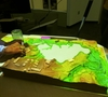
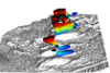
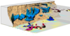
Tangible Landscape (formerly TanGeoMS)
Tangible Landscape (formerly known as TanGeoMS) is a collaborative modeling environment for analysis of terrain changes. We couple a scanner, projector and a physical 3D model with GRASS GIS. We can analyze the impact of terrain changes by capturing the changes on the model, bringing them into the GIS, performing desired analysis or simulation and projecting the results back on the model. We develop Tangible Landscape as a collection of free and open source software where GRASS GIS plays a major role as an analytical tool.
-
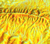
Multidimensional geovisualization in GRASS GIS
We are developing geovisualization methods to analyze landscape evolution through time and space. We apply space-time cube approach to visualize evolving elevation contours as isosurfaces with additional attribute expressed by color. Additionally, we animate dynamic processes including water flow, sediment transport and fire spread, and project them on physical models in our TanGeoMS environment. As for our study sites, we focus on rapidly changing landscapes, such as the Jockey's Ridge on the Outer Banks, NC. We extensively use GRASS GIS both for modeling and for analytical 3D visualizations and animations.
-
GIS-based soil erosion/deposition modeling
We develop GIS-based tools and applications for modeling erosion and deposition patterns in complex landscapes. We use the models to map areas with high erosion and deposition potential providing information for sustainable land use management. We also provide support for erosion modeling used in simulations of coupled human-natural systems.
-
Terrain dynamics analysis using voxel models and lidar data time series
We develop visualization and analytics tools to provide insight into short term evolution of landscapes with rapidly changing topography. We use space-time cube concept to visualize elevation contour evolution as isosurfaces and investigate spatial patterns of space-time gradients.
-
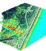
Coastal dynamics and sustainability
We analyze and visualize barrier island terrain dynamics using time series of lidar data. We have developed set of metrics that quantifies short term sand redistribution, shoreline evolution and sand dune migration. Our GIS-based methods provide tools for mapping barrier island vulnerability to storm surge and to extract important terrain features used as inputs for coastal process simulations.
-
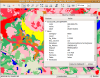
GRASS GIS Graphical User Interface
We are actively contributing to the GRASS GIS GUI by adding and improving visualization tools and maintaining the present code. We get feedback from students using the software during the classes as well as from GRASS GIS user community.
GRASS GIS GUI development includes Python programming with wxPython graphical toolkit.
-
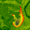
GIS-based fire spread modeling
We use GRASS GIS wildfire toolbox to simulate fire spread based on terrain, available fuel and wind.
-
GRASS GIS functionality testing
Besides manual testing of GRASS GIS functionality we also do automatic testing. We develop testing framework, tests and we also run the tests in automated way.