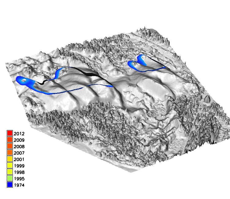
Terrain dynamics analysis using voxel models and lidar data time series
We use space-time cube approach to analyze how terrain evolves. By stacking a time series of digital elevation models, we create an elevation voxel model, which can be then visualized by isosurfaces. Elevation isosurface is a 3D analog of a contour, thus it represents the change of a particular contour line in time.