Courses
-
GIS/MEA582: Geospatial Analysis and Modeling
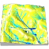
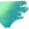
The course explains digital representation and analysis of geospatial phenomena and provides foundations in methods and algorithms used in GIS analysis. Special focus is on terrain modeling, geomorphometry, watershed analysis and introductory GIS-based modeling of landscape processes (water, sediment). The course includes analysis from lidar data, coastal change assessment and 3D visualization. All assignments are done in two software packages – GRASS GIS and ArcGIS – to untangle general geospatial analytical concepts from software specifics. The GRASS GIS part is very popular even outside NCSU.
-

GIS610-003/603: Tools for Open Geospatial Science
The course covers emerging field of open science and deals with reproducibility and replicability challenges of computational research. The students gain a hands-on experience with tools used by scientists to create geospatial research which can be validated by the wider geospatial community. Several geospatial open source tools are discussed in connection with general-purpose and text authoring tools such as next generation interactive documents and revision control tools. Although the focus of the course is open science, many of the tools used in the course are used in the industry. The course covers how open source communities and software development process work and how to apply this for research in a lab group.
-
GIS595/MEA792: UAV/lidar Data Analytics
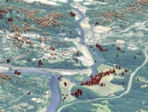
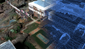
The course covers monitoring, analysis, and modeling of 3D landscape change using Unmanned Aerial Systems (UAS) and lidar data. The principles of UAS data collection, processing of 3D point clouds and the resulting terrain models are explained followed by hands-on experience with multitemporal data collected by the NCSU NextGen Air Transportation (NGAT) program. The course also covers techniques for analysis and visualization of lidar data time series and outputs of dynamic simulations, including immersive visualization at the Hunt library facilities. The students will have the opportunity to work with the Tangible Landscape system to explore impact of 3D terrain change on landscape parameters and processes.
-
GIS714: Geospatial Computing and Simulations
This course focuses on theoretical concepts and computational methods that describe, represent and simulate the functioning of real-world processes. We define the general properties of geospatial computation and explain the role of simulations in analysis and understanding of observed phenomena, testing of hypotheses and theories, and prediction of spatio-temporal systems behavior. We discuss the current methods and techniques for simulations using deterministic, stochastic and rule-based models as well as agent-based simulation of complex systems. Hands-on component of the course will cover implementation of simulations in GIS and advanced applications driven by the student’s research. Open science tools will be used for assignments. Prior programming experience is expected.
Courses are offered through different educational programs at NCSU Center for Geospatial Analytics.
Workshops and tutorials
-
OpenGeoHub 2023: Parallelization of geoprocessing workflows in GRASS GIS and Python
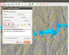
High-resolution, continental-scale modeling enabled by modern, massive datasets, requires development of scalable geoprocessing workflows. To enable participants to effectively use available computational resources (laptop, desktop, institutional HPC), we will introduce basic parallelization concepts such as parallelization efficiency and scaling. We will explain various approaches to parallelization in GRASS GIS, an open source geoprocessing engine, that rely on OpenMP, Python and Bash.
-
Developing custom GRASS tools (FOSS4G 2022 workshop)
Learn how to develop custom tools (aka addons or modules) for GRASS GIS in Python and, if you like, in C.
-
Unleash the power of GRASS GIS with Jupyter (FOSS4G 2022 workshop)
We will explain and practice GRASS GIS concepts like location, computational region, or mask and demonstrate them on examples of efficient raster, vector, and imagery processing. We will go through several options to parallelize your workflows that are applicable for various computing platforms including your laptop and HPC. Finally, this workshop will be run in a JupyterLab environment, taking advantage of the latest GRASS GIS Python features for Jupyter, including pretty 2D, 3D, webmap, and temporal visualizations.
-
GRASS GIS: From Beginner to Power User (FOSS4G 2021 workshop)
In this workshop, we explain and practice various GRASS GIS concepts. We go through simple, yet useful examples of vector, raster, and image processing functionality. Building on these examples, we employ Python scripting to parallelize our workflows to get you ready for your next big data project. This workshop was created for FOSS4G 2021 and delivered virtually using Jupyter Notebooks hosted on Binder.
-
GAPS: Tangible Landscape Activities
These activities lead students through an introduction to geospatial computation simulation and modeling using a geospatial tangible interface - Tangible Landscape.
-
Geodesign with Blender
This tutorial has several components, starting with introduction to Blender and its interface. It further includes: advanced shading and rendering of remote sensing imagery, working with geospatial data (viewshed example), photorealistic landscape modeling, 3D web GIS with Blend4Web, and processing of UAV data.
-
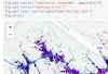
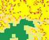
Visualizing Raleigh crime data with Kepler.gl
In this tutorial, you use Kepler.gl an open-source data visualization tool created by Uber's data visualization team to visualize crime data in Raleigh, North Carolina from the city's open data portal. By completing the tutorial you will learn how to add data into Kepler.gl and customize it using various marks, channels, and filters.
-
Visualizing California wildfire data with Dash
Dash is a Python framework for building interactive web applications for data visualization. Dash is rendered in a browser and uses CSS, so it is highly customizable and easy to share via URLs. Dash uses purely Python with html components and Plot.ly graph objects. This tutorial will demonstrate how to create a basic dashboard application showing a bubble chart, map, and interactive filtering with a range slider.
-
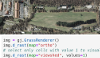
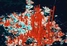
Processing lidar and UAV point clouds in GRASS GIS
This workshop shows the tools in GRASS GIS for processing point clouds obtained by lidar or through processing of UAV imagery. It includes exploring the properties of a point cloud, interpolating surfaces, and performing advanced terrain analyses to detect landforms and artifacts. It goes through several terrain 2D and 3D visualization techniques and finishes with vegetation analysis. This workshop was created for FOSS4G 2017.
-
From GRASS GIS novice to power user
We aim this workshop at absolute beginners without prior knowledge of GRASS GIS. It includes introduction to GRASS GIS folder structure and environment, graphical user interface and command line, and Python scripting. We go through simple examples of vector, raster, and image processing functionality. This workshop was created for FOSS4G 2017.
-
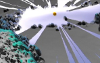
Real-time 3D visualization of geospatial data using Blender
What if your geospatial data and simulations are converted on-the-fly into realistic, interactive and immersive 3D worlds? We explore how to automate importing and processing of various types of geospatial data using Blender, an open-source 3D modelling and game engine software. This workshop includes introduction into Blender GUI and goes over the techniques to increase the realism of our 3D world through applying textures, shading, and lighting. This workshop was created for FOSS4G 2017.
-
Analytical data visualizations with GRASS GIS and Blender
We introduce GRASS GIS and Blender, and show examples of their processing capabilities and visualization techniques on viewshed modeling case study. This workshop was created for ICC 2017.
-
Unleash the power of GRASS GIS
This workshop provides a step by step tutorial to guide beginners from basic raster and vector analysis to more complex topics such as landscape structure analysis, lidar data processing, and spatio-temporal data handling and visualization. You will also learn how to use GRASS GIS with Python to optimize your workflows, and how to leverage the integration of R with GRASS GIS for statistical analysis. This workshop was created for US-IALE 2017.
-
Using GRASS GIS through Python and tangible interfaces
Learn about scripting, graphical and tangible interfaces for GRASS GIS, the powerful desktop GIS and geoprocessing backend. We start with the Python interface and finish with Tangible Landscape, a tangible interface for GRASS GIS. This workshop was created for FOSS4G NA 2016.
-
Workshop on urban growth modeling with FUTURES
This workshop introduces GRASS GIS and FUTURES urban growth modeling framework. This workshop was created for US-IALE 2016 Annual Meeting.
-
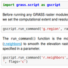
How to write a Python GRASS GIS 7 addon
Introduction to all parts of scripting for GRASS GIS using Python programming language. Advanced techniques required to create fully blown GRASS GIS module which can be published as an addon are shown as well. This workshop was created for FOSS4G Europe 2015.
-
Introduction to GRASS GIS
Introduction to geospatial processing with GRASS GIS. The course covers basic control of the graphical user interface, invoking GRASS modules in different ways including scripting and various geospatial analysis.
-
Spatio-temporal data handling and visualization in GRASS GIS
First, we will introduce you to GRASS GIS 7, including its spatio-temporal capabilities and you will learn how to manage and analyze geospatial data time series. Then, we will explore new tools for visualization of spatio-temporal data. You will create both 2D and 3D dynamic visualizations directly in GRASS GIS 7. Additionally, we will explain the Space Time Cube concept using various applications based on raster and vector data time series. You will learn to manage and visualize data in space time cubes (voxel models). No prior knowledge of GRASS GIS is necessary, we will cover the basics needed for the workshop. This workshop was created for FOSS4G 2014.
-
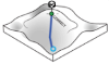
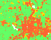
Soil erosion and deposition modeling
This tutorial focuses on modeling erosion and deposition patterns in complex landscapes. It explains the concepts behind soil erosion and deposition estimation including different methods (USLE, USPED). The GIS workflows are available for both GRASS GIS and ArcGIS including detailed instructions and figures. The tutorial has been prepared using data from the Ft. Hood installation. Basic GIS knowledge is recommended.
-
Git and GitHub workshop
This workshop covers the differences between Git and GitHub and provides brief introduction to basic Git commands to help researchers start using it for their own projects.
More materials available in list of old and less related courses and tutorials.